Heading back from L’Isle Sur La Sorgue market this week I thought I’d take the opportunity to stop at Cabrières D’Avignon and seek out a walk that I had heard about that follows some of the ‘Mur de La Peste’.
The Mur de la Peste, which ran for over 27km between The Durance and Monieux was built in 1721 with the aim of preventing ‘The Plague’ , which was devastating much of the area, from spreading into the Comtat Venaisson and on towards Avignon.

The drystone wall was designed by Antoine D’Allemand (an engineer from Carpentras) to act as a defined barrier and prevent human contact between those carrying the disease and the protected area. It was built with guard posts at regular intervals, manned by Papal and French troops who had orders to prevent passage across.
Sadly it didn’t achieve its purpose and The Plague, which had originated in cloth brought into Marseille on the ship ‘Great Saint Anthony’, spread beyond the port, destroying lives and communities until it died out in 1723.
During this period 81 communities were affected across Provence & The Comtat, with 126,000 people (36% of the total population) losing their lives.
The original ‘Mur de La Peste’ has, on the whole disappeared, with much of stone having been taken for other use, but near Cabrières is a stretch that has been restored and it makes for a nice walk.
I started by parking at the Mairie, following the road into the centre of the village, passing the Church on the right hand side.

It was good to see the way to the wall clearly signposted at the junctions as I went through the village, always a positive start when you don’t have a map!

In the centre of the village the route bears to the left, taking you past the Chateau, outside which was a carved stone highlighting a massacre of Vaudois people who had taken refuge there between 19-20 April 1545.

This was one of several attacks on the Vaudois, who had been declared heretics for their beliefs, which were deemed to fly in the face of traditional Catholicism at the time. It appears that there were 400-500 victims in this place alone and many more across the area. A truly sobering thought.

After passing the Chateau the route is again well-signed taking a left onto a No Through Road, that passes houses…
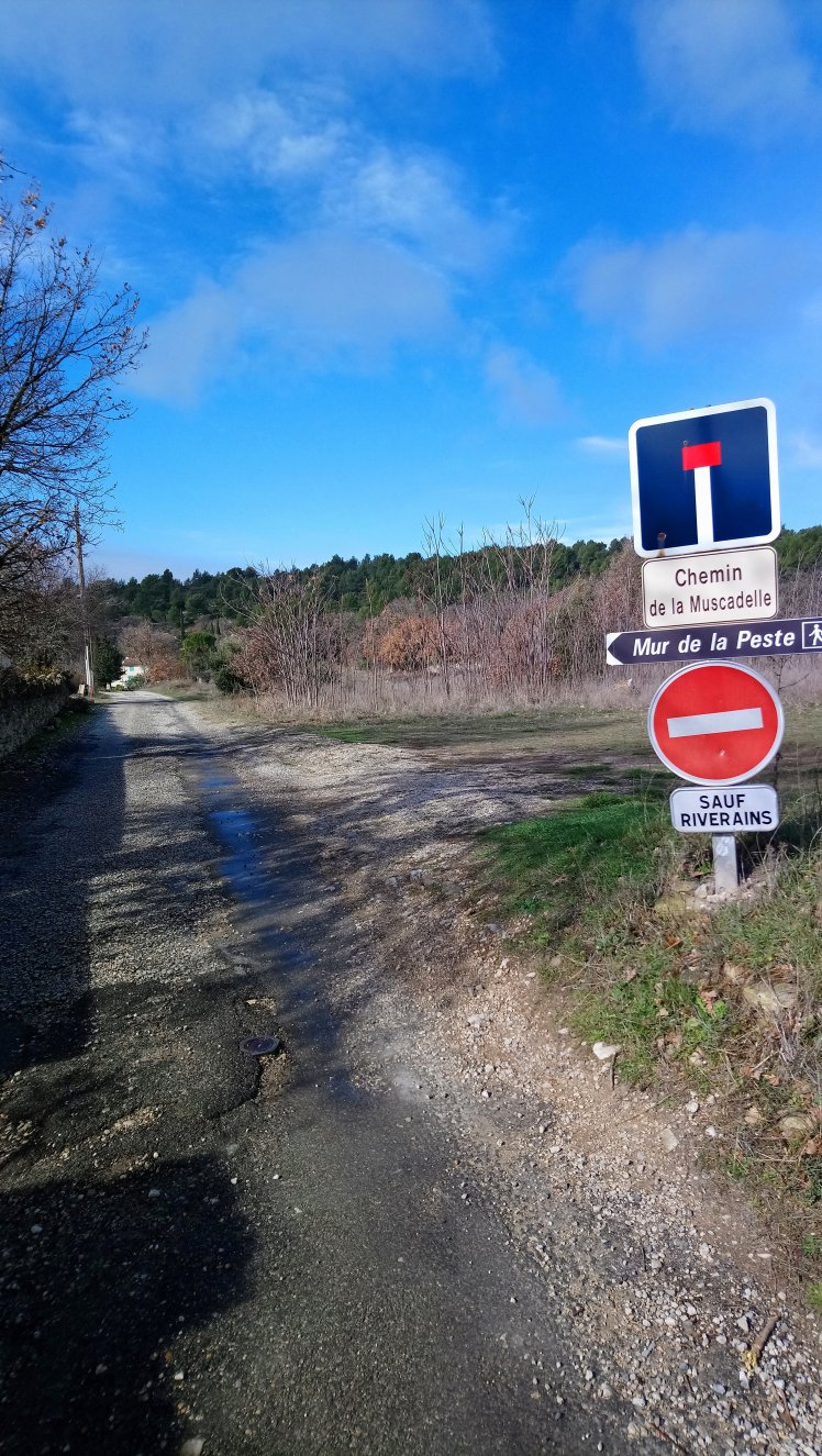
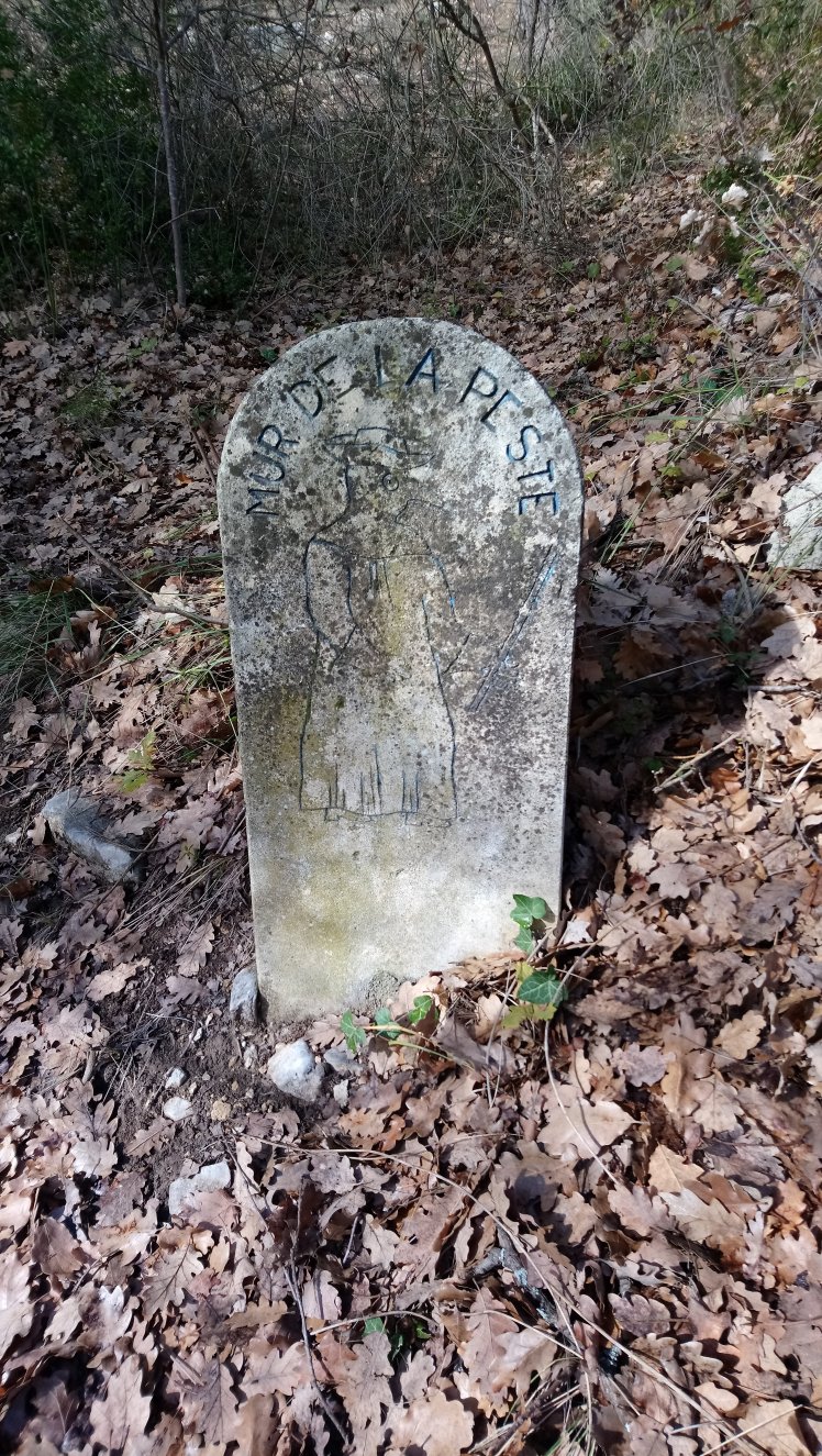
… before it becomes a stony track leading up into woodland. Here a stone carved with the outline of a ‘Plague Doctor’, wearing robes and a ‘beaked’ mask, confirm you are on the right route.
Continuing along this route, now marked with red & yellow stripes, you continue to climb until meeting a small stone obelisk. It isn’t marked to explain its purpose, but you continue straight past it & start to drop down the far side of the hill.

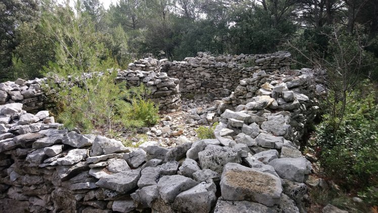
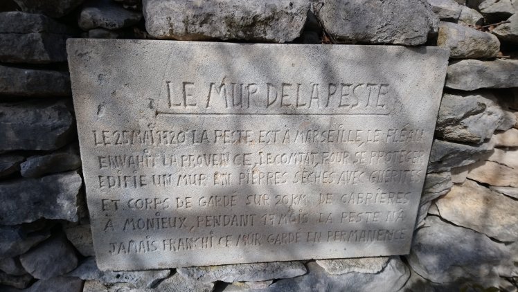
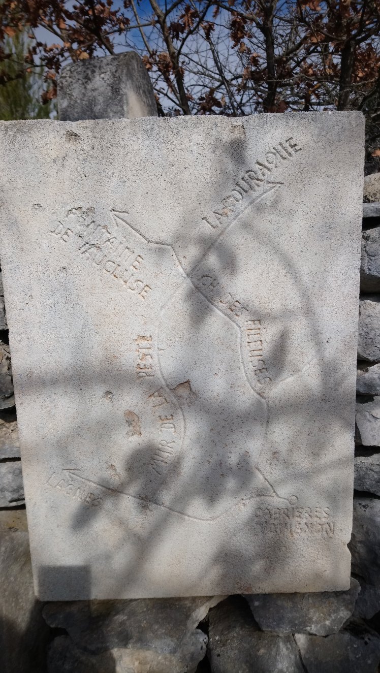
After a few hundred metres, following the stony track you arrive at the start of the wall, in a place known as Bourbourin, identified as one of the trading posts along it……
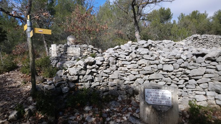
…. Where there is also a plaque giving a little bit more information about the wall.
Here you turn right and follow the route of the wall up a gentle incline for about 1km.
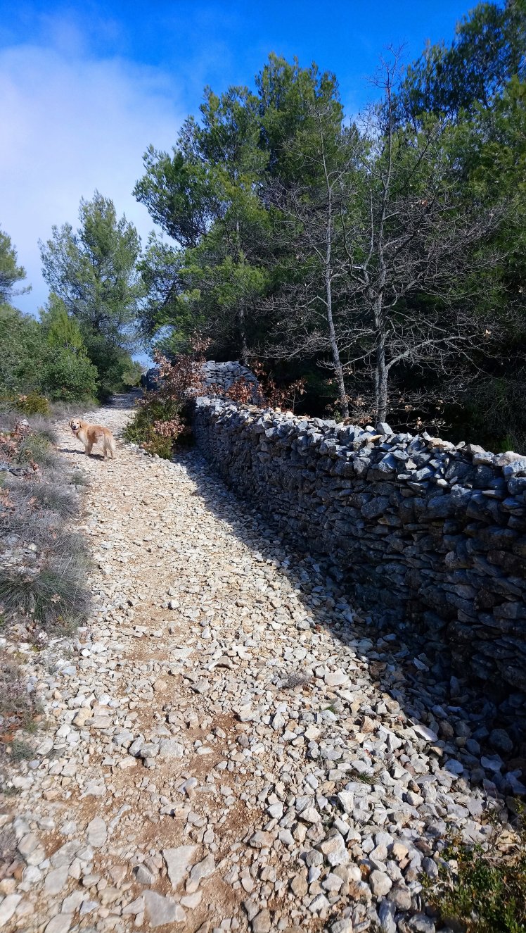
The sheer size of the wall and its construction give you a sense of its scale and how it must have dominated the landscape when it was originally built.
There are regular constructions within it that must have been guard posts – (I have read that 1000 guards were placed along the wall) and occasional openings to allow some passage through for those able to prove they were from an unaffected area.

It must have been a massive task to build it, without the labour-saving devices we have now and I can’t even start to imagine how many people must have been involved to construct it in such a short time.
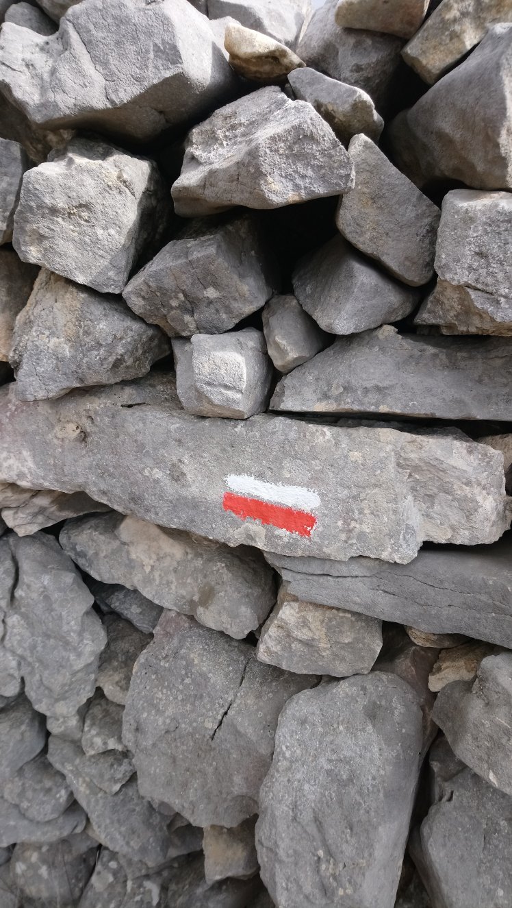
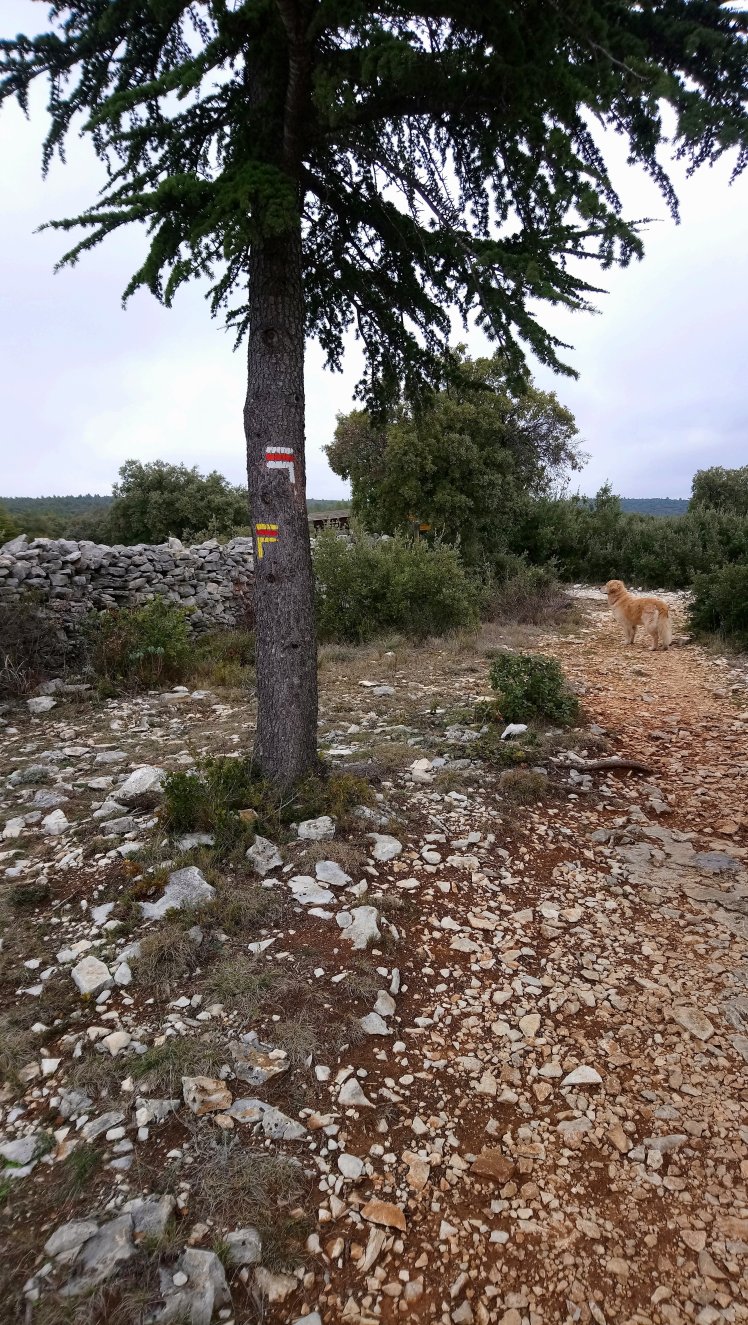
After a while the wall ends and you continue to follow the well-defined trail, marked with both red & white and red & yellow stripes.
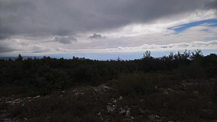
Once past the wall the trees open out & you get great views back towards the village and the Luberon in the distance.
Follow this trail until you reach a large junction, where a number of paths cross.
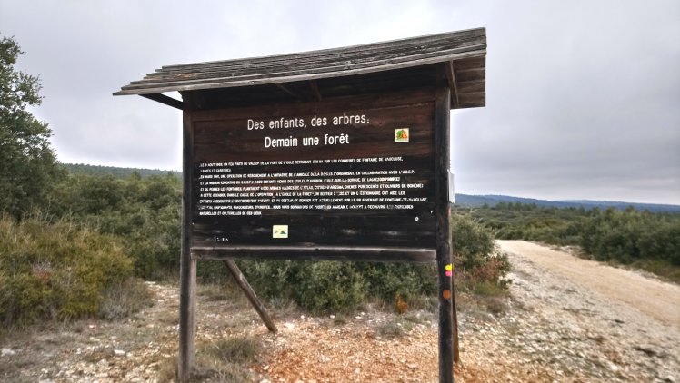
Just to the left though there is a large sign that marks the site of a Forest Fire, which destroyed 338 hectares of woodland in August 1989. It details how over 1000 children from local schools subsequently took part in a tree-planting programme to replace those that had been lost.
Here you turn a sharp right, following just the red & yellow markers as they take you back down towards the valley.
As you head down along the stony trail the views again open up and you get glimpses towards Gordes…
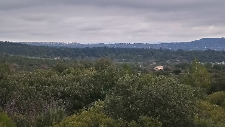
And back down to the village…

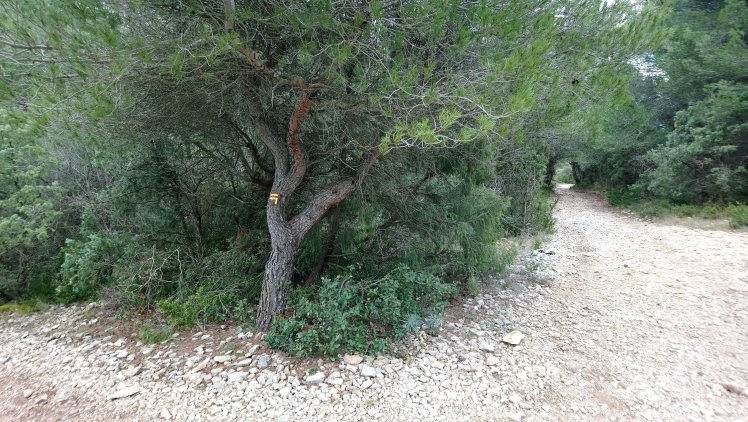
Just after a small cemented ‘dew pond’ on the left you will see a trail leaving the main path to the left, marked with the red & yellow stripes on a tree…
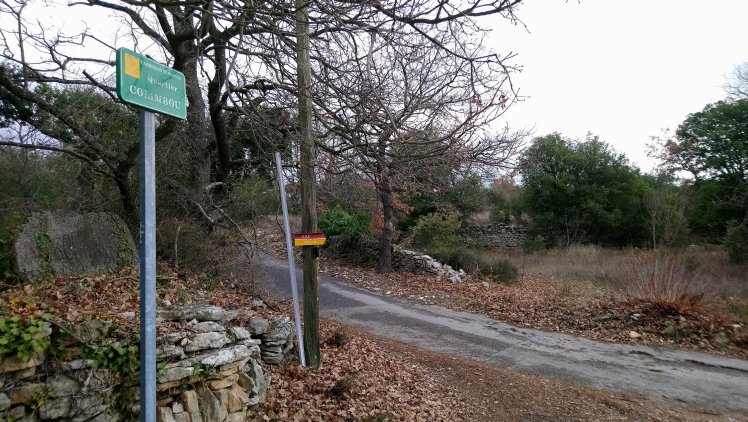
This route continues down the hill, through woodland, before emerging onto a side road in The Quartier Colimbou. Although it’s tempting to turn right, the route is signposted to the left along the road.
A short distance further on you bear right onto the Chemin des Fileuses (spinners), a track through Olive Groves, bordered by a low stone wall with occasional small structures along it…

I couldn’t help but wonder how much of this stone had been part of the original ‘Mur de la Peste’
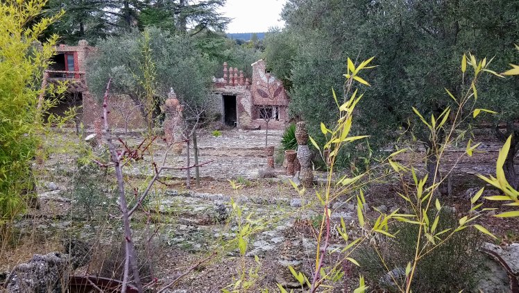
Towards the end of this track is an amazing garden filled with structures & designs that appear to be made from broken old terracotta pots and crockery. Bizarre but certainly like nothing I have seen before

The designer & creator has clearly spent many hours on it as almost every surface had been covered in the mosaic.
Shortly after this you reach a tarmaced road, turning right to return to the village, entering past the old Lavoir, en route back to the Mairie.

There is always a chance to stop at Le Vieux Bistrot the in the village on the way back https://m.facebook.com/vincentlantelme/about/?mt_nav=1/ for some much-needed refreshment.
Another delightful walk of about 6km taking just under 2 hours which took me through some beautiful countryside with great historical context.
And of course Millie enjoyed it too!

I left a dog leash on that trail. Did you happen to find it by any chance?
LikeLiked by 1 person
Sadly not, but heading back there later so will keep an eye out for it 😉
LikeLike
This walk is definitely on my to do list!
LikeLiked by 1 person
That’s great to hear – it is very lovely& the history behind it is fascinating
LikeLike
Thank you for sharing. Great pictures, good comments. I am fascinated by the plague and hope to see the wall next week. Stef Jacobs, Amsterdam
LikeLike
Thanks it is a lovely walk & I love the history of it so hope you enjoy it – if it’s still as hot as it is today take plenty of water as the wall acts like a radiator at the moment 🙂
LikeLike
Thanks for a nice description and lovely photos! Do you know if it is a path for the whole distance of the wall? Should be 27 km.
LikeLiked by 1 person
Hi, thanks …. Unfortunately not, most of the wall has disappeared, but this section has been restored. There are footpaths that follow some of the old route elsewhere, but I think this is the best section
LikeLike